
 Yahoo Autos
 The cure for winter flooding might be in this swamp — if California actually funds it
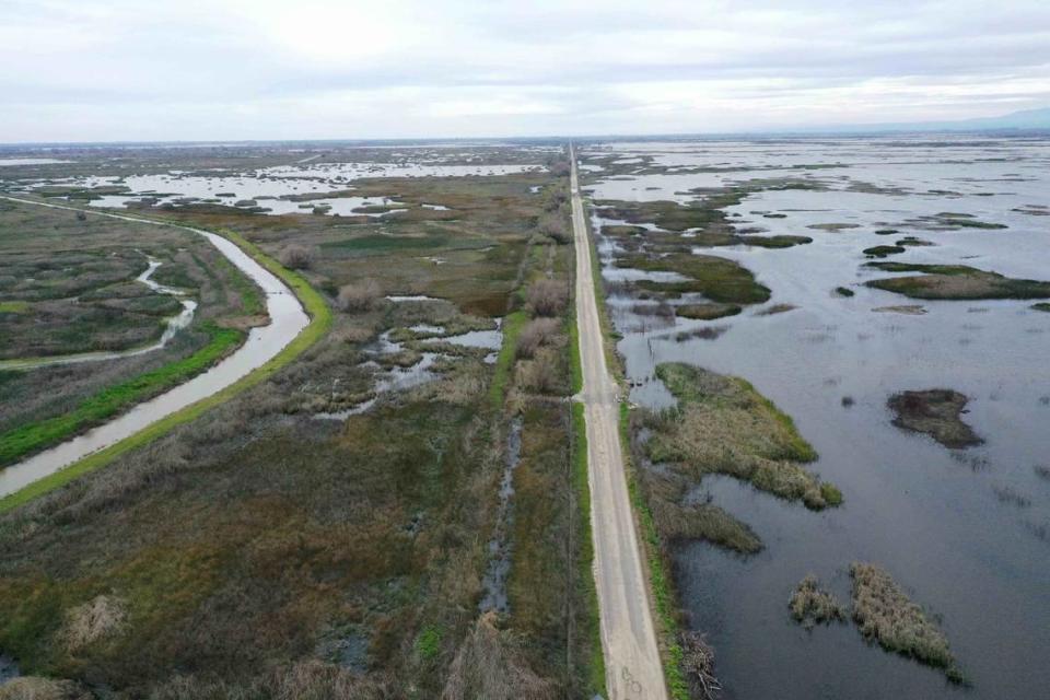
Matt Kaminski stood on a road scarcely higher than the floodplain, glassy pools on all sides stretched out like something from a dream. In the distance, a storm lumbered over the Coast Ranges.
The marsh all around him, Kaminski said, was a window into the Central Valley’s past. Back then, the waterways that twist down from the Sierra Nevada mountains would flood unrestricted by the current thicket of dams, canals and levees.
The more you know about rivers, the less confidence you have in a mapmaker’s static squiggle. Kaminski, a biologist from Ducks Unlimited who helps oversee the floodplain and, when it dries out, the grasslands, explained that when “the state of California was wild, it had a lot more wetlands.”
During the rainiest years, the whole valley could transform into an enormous, shallow sea. Floodwaters would spread over the landscape and percolate through the soil into the aquifers beneath. Little aquatic creatures would make their home in the tules and migrating birds would stop to gorge on their long journeys in the spring and fall. The Valley oaks and Fremont cottonwoods would rise, improbably, out of the shallows.
That appeared to be happening just east of Gustine in Merced County, as yet another storm from the tropics approached the valley: The San Joaquin River seemed to spread out and create an ephemeral wetland, a natural process.
But Kaminski pointed to the edge of the water, where three concrete slabs jutted into the marsh, and little slats of wood controlled the flow under the dirt road to the other side.
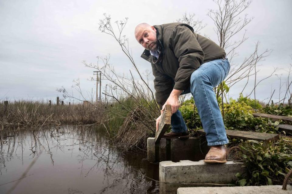
This marsh hadn’t flooded on its own.
Instead, the wetland was an artifice on top of an artifice. Powerful California interests “reclaimed” the Central Valley’s wetlands in the 19th and early 20th centuries, draining them for agricultural use and transforming the landscape.
The vast majority of the state’s marshes are gone.
But in little pockets in the state, people like Kaminski are reworking the land yet again to bring back a version of California’s past, in service of the future. By allowing rivers to spread out, flows are diverted from downstream communities, replenishing groundwater and staving off unwanted floods.
“These wetlands,” Kaminski likes to say, “act as a sponge.”
And the state agreed. In September, the California Wildlife Conservation Board earmarked $40 million for the nonprofit River Partners to spend on similar projects in the San Joaquin Valley.
But in the governor’s proposed budget released in January, that funding was axed. The news came early in the procession of climate-change-fueled winter storms that have led to staggering snowpack in the Sierra, extensive flooding throughout the state and more than 30 deaths. Facing a budget shortfall, Gov. Gavin Newsom had moved to kneecap efforts to use the historical floodplain as a way to recharge groundwater and to prevent disasters in human-occupied areas.
“In the San Joaquin Valley, we’ve got a product pipeline of about $200 million worth of floodplain expansion projects that are ready to go,” said Julie Rentner, president of River Partners. But the proposed budget, she said, “has zero dollars to be used towards that pipeline.”
Rentner said that habitat restoration cannot wait.
“Something as critically important as floodplain expansion — especially tested out this year, with these big, high flows,” Rentner said, “is not something that is easy to press pause on.”
What good is a marsh, anyway?
This particular wetland that Kaminski helps run — alongside the landowners — is two adjacent areas, one publicly and one privately managed. The Great Valley Grasslands State Park and the Kesterson National Wildlife Refuge are where the river overflowed from its banks (and, this year, flooded a parking lot). To the west, the duck club lands use water that ultimately travels from Lake Shasta, providing critical habitat in the Pacific Flyway.
The public lands are upstream from Tracy and Manteca. Spreading out and slowing down the charging San Joaquin River helped mitigate flooding in those communities.
“Private and public lands allow these rivers to expand,” Kaminski said, “which takes the burden off the cities that are downstream.”
Artie Valencia, a Stockton-based community organizer with Restore the Delta, explained that wetlands “will help take the pressures off the levees during extreme rain events and atmospheric river events, and so forth.”
That was especially important in places that faced generational disinvestment from the state, such as Stockton, whose levees, Grist reported, are in decay.
These wetlands also make the water cleaner, Valencia said.
“You put in plants like tules, which are really good at absorbing pollutants and other types of inorganic matter, and cleaning the water,” she said. “Basically filtering it.”
These projects had benefits for non-humans, too. The area is a breeding ground for fish. Collapsing populations of Chinook salmon could swim through the floodplain.
Kaminski is most interested in the birds: “As you get to see, all these ducks that are still here that are just waiting to go north, they’re really utilizing this expanded habitat.”
