Deadly cyclone 'Freddy' may be the longest-lived and most energetic storm ever recorded

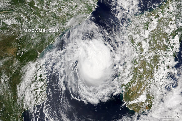
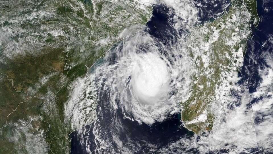
A super-powered cyclone named "Freddy" has likely broken a number of mindblowing records since it formed in early February. The monstrous storm has crossed the Indian Ocean and made landfall three separate times, and may be the most energetic and long-lasting storm ever recorded.
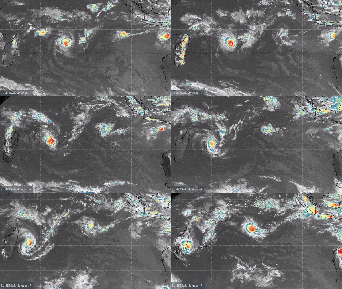
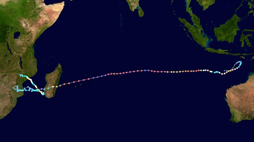
Freddy was first named on Feb. 6 after forming off the north Australian coast. Since then, it has traveled more than 5,000 miles (8,000 kilometers) across the southern Indian Ocean to southeast Africa, where it finally appears to be dying down, according to the World Meteorological Association (WMA).
After damaging infrastructure on the islands of Mauritius and Réunion, which both avoided a direct hit, Freddy first made landfall on Feb. 21 as it plowed across the island nation of Madagascar. From there, the storm made landfall at Mozambique on Feb. 23 before briefly heading back out to sea, where it narrowly missed Madagascar again before turning around once more to hit Mozambique again on March 11, along with Malawi and Zimbabwe.
At least 148 people have been killed by Freddy and another 19 are missing, with death tolls likely to rise, according to the United Nations' Office for the Coordination of Humanitarian Affairs (OCHA).
Related: Bermuda's hurricanes are twice as strong as they were six decades ago

The cyclone dumped a mind-boggling amount of rain on land, leading to mudslides and flooding that have displaced tens of thousands and worsened a cholera outbreak in Malawi. Southern Mozambique received more than double its annual rainfall duringFreddy's landfalls, and Malawi received around 1.6 feet (0.5 meter) of rain in just 72 hours, according to WMA.
The cyclone has now moved back out to sea, where it is expected to finally dissipate.

Record-breaker
Though this still needs to be confirmed with storm data, Freddy is likely the longest-lived tropical cyclone on record, having lasted for at least 35 days. The previous record was set by Typhoon John, which whirled across the Pacific for 31 days in 1994. (Cyclones, which form in the southern hemisphere; hurricanes, which form in the Atlantic Ocean; and typhoons, which form in the Pacific Ocean, are collectively known as "tropical cyclones.")
Freddy has also released an astonishing amount of energy during its long life. Scientists measure this using the accumulated cyclone energy (ACE) index, which tracks wind speed data over time. By Feb. 23, Freddy already had an ACE index of 66, making it the most powerful cyclone ever recorded in the Southern Hemisphere, according to the National Oceanic and Atmospheric Administration (NOAA).

By March 12, Freddy had reached an ACE index of 86, The Washington Post reported. If confirmed, that would make it the most energetic tropical cyclone ever recorded on Earth. The current record holder was Hurricane Ioke in 2006, which had an ACE index of 85.2.
Why has Freddy lasted so long?
Freddy has lasted so long because it has undergone several periods of restrengthening, where surrounding weather fronts strengthen wind speeds after they initially die down. Freddy has undergone at least four restrengthening events, which is the most ever seen in a tropical cyclone, according to NOAA. Further research will be needed to determine why this happened.
RELATED STORIES
—Surprising loss of sea ice after record-breaking Arctic storm is a mystery to scientists
—Record-breaking winds blast Europe in the worst storm in decades
—'Mad Max'-like dust storm envelops Brazilian city in cloud of doom
NOAA experts also think that La Niña, an atmospheric phenomenon that cools large regions of Earth's oceans, could have played a role. The last two storms to take a similar path to Freddy across the Indian Ocean occurred in 2000, when there was a rare triple-dip La Niña that lasted three years. The current La Niña is also in its third year.
Experts suspect that human-caused climate change has played a role in strengthening the storm, although it is too early to say exactly how, according to WMA.
This story originally appeared on Livescience.

 Yahoo Autos