
 Yahoo Autos
 Global warming driving more extreme droughts and floods, NASA satellites show
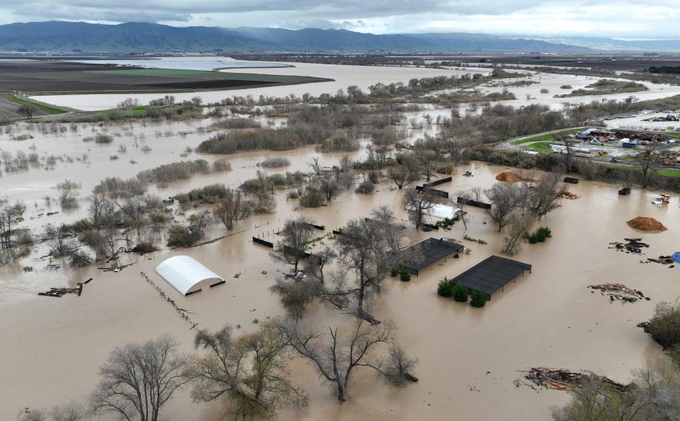
Twenty years of NASA's global satellite data show just how much the extent, duration and severity of extreme droughts and floods have risen alongside warming global temperatures, a new study reveals.
The study looked at the timing of such events and where they're happening around the world, said study co-author Matthew Rodell, a scientist at NASA'S Goddard Space Flight Center.
Published in the journal Nature Water, the study found a strong correlation between extreme wet and dry events and temperature increases.
More extreme events — more frequent, bigger and more severe — occurred in the later years, since 2015, which have ranked among warmest top 10 on record, Rodell said.
The work adds to a growing body of evidence that suggests continued warming could cause more frequent, widespread and severe droughts and floods.
How does climate change affect you?: Subscribe to the weekly Climate Point newsletter
READ MORE: Latest climate change news from USA TODAY
Weather events are changing
When you have warmer temperatures, you see these more intense events happening, and happening more frequently, Rodell said. It’s “highly likely that as the world continues to warm, we will see more frequent and more severe droughts and (periods of increased rainfall)."
Warmer air causes more evaporation during droughts and increases the amount of water available in thunderstorms and other precipitation during wet events.
A USA TODAY investigation in 2021 showed extreme rainfall has increased in the eastern half of the United States but that droughts were growing more frequent and more intense.
Investigation: How a summer of extreme weather reveals a stunning shift in the way rain falls in America.
Years of study had predicted this could be the case, but like the investigation, most academic studies use rainfall data.
Rodell and Bailing Li, employed by the University of Maryland at the Space Flight Center, used information from NASA satellites. Rodell said the more precise data helps account for underestimates that occur in extreme precipitation data and for uncertainties in rain and snow measurements at higher elevations.
What did the scientists do?
Observed: Changes in land-based water storage measured by remote-sensing satellites, including groundwater, soil moisture, snow and ice and surface waters around the world.
Found: 505 wet events and 551 extreme dry events from 2002-2021, with an average duration of 5-6 months.
Analyzed: Monthly temperature records and monthly total intensity of all wet and dry events and compared them.
