Yahoo Autos
 Heads up, travelers: a gusty, wintry mix is coming to Vermont
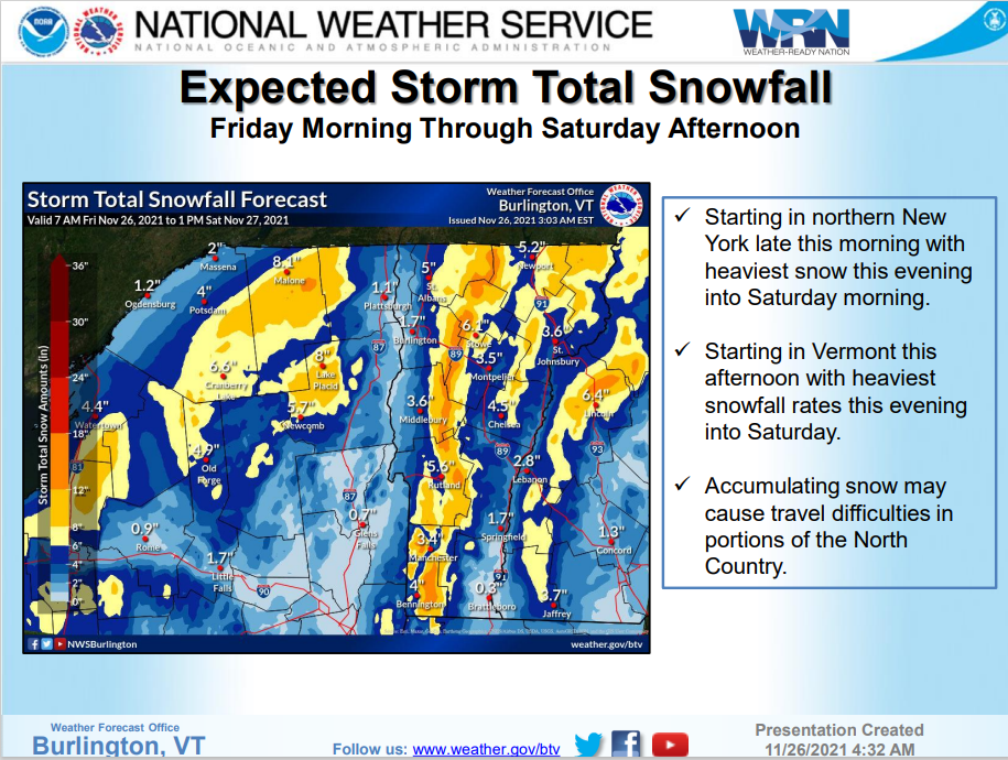
A fast-moving cold front will bring to Vermont a blustery "hodge-podge" of wet snow and ice Friday and Saturday, according to National Weather Service predictions.
Motorists should be prepared for hazardous driving conditions, the weather service warned — and allow extra time for trips.
The storm is on track to arrive during the Friday evening commute in Chittenden County, said weather service meteorologist Jessica Neiles.
Higher elevations along the Green Mountains have been placed on a winter storm warning, with up to 20 inches blanketing ridges from Mt. Mansfield down to Mt. Ellen.
Roadways throughout the state will likely become slick, the weather service stated. High winds are predicted to reduce visibility, and to deliver wind-chill temperatures into the single-digits.
Offering shelter: Vermont expanding homeless access to motels during winter