
 Yahoo Autos
 UPDATE: 3 feet of snow forecast on Oregon mountain passes, snow possible in valley
Story updated at 8 a.m. on Thursday, March 22
Heavy snow in the Cascade mountains and the possibility of low-elevation snow, perhaps as low as the Willamette Valley, could throw a wrench into spring break travel plans late this week and into the weekend.
A winter storm warning for up to three feet of snow at Cascade Mountain pass levels — and around a foot of snow on Coast Range passes — has been issued for Thursday to Saturday in northwest Oregon.
The snow could make travel across the mountains difficult to impossible even as spring break plans to hit the road ramp up.
In the Willamette Valley and Columbia Gorge, there will be multiple chances for low-elevation or valley snow during nights and mornings from Thursday to Sunday, National Weather Service meteorologist David Bishop said.
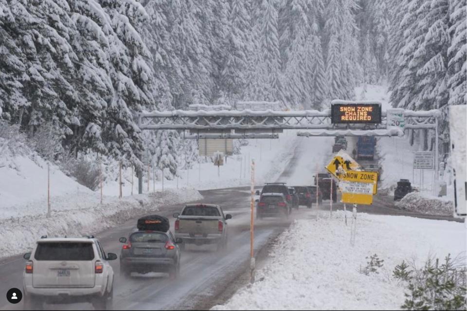
Major mountain snow forecast
What’s clear is heavy snow is likely to impact anyone traveling between the Willamette Valley and Central Oregon. This particularly applies to travel over Santiam Pass (U.S. Highway 20), Willamette Pass (Highway 58) and the Mount Hood area (Highway 26).
“If people are traveling for spring break late this week and the weekend, they should be aware, check the forecast and check TripCheck.com,” Bishop said.
Coast Range Highways between the Willamette Valley and Oregon Coast could see 4 to 12 inches, mainly at the higher elevations.
The heaviest snow and worst travel conditions appears to start letting up by Friday evening and into Saturday, but plenty of additional snow still is forecast for the mountain passes through Saturday.
Low-elevation, Willamette Valley snow unclear
It’s much less clear whether snow will actually fall near the Willamette Valley.
There is cold air swinging into northwest Oregon that could drop snow levels as low as 500 to 1,000 feet, which could impact the higher parts of cities such as Portland, Salem and Eugene. That low elevation snow will be possible every night and morning from Thursday to Sunday morning.
“Right now we can say there is that possibility,” Bishop said. “The forecast could change quite a lot, but right now we’re putting it at a 20% to 30% chance of more than an inch of snow below 1,000 feet.”
Chances of snow are higher in the Columbia Gorge, where showers will be most numerous, meteorologists said.
"Snow will be most likely to accumulate during the late night and early morning hours, when ground temperatures are the coolest. Temperatures are expected to gradually moderate beginning Sunday, ending the potential for lowland snow," added NWS meteorologist Shawn Weagle.
"Daytime high temperatures are warm enough that any snow that did fall would not last long," Weagle said.
Bishop said even if snow doesn’t arrive, heavy hail could arrive on Friday during particularly heavy downpours.
Snow also possible in southern Oregon, Washington
Anyone traveling Interstate 5 into California or Washington will face similar challenges. Six to 12 inches is forecast for I-5 at Siskiyou Summit, on the Oregon-California state line, while other mountains roads in southwest Oregon could also be hard hit.
Is it odd to have snow this late?
While it is getting late in the season for potential snow in the Willamette Valley, it's certainly not unheard of and has happened in recent history, Bishop said.
Zach Urness has been an outdoors reporter in Oregon for 15 years and is host of the Explore Oregon Podcast. Urness is the author of “Best Hikes with Kids: Oregon” and “Hiking Southern Oregon.” He can be reached at zurness@StatesmanJournal.com or 503-399-6801. Find him on Twitter at @ZachsORoutdoors.
This article originally appeared on Salem Statesman Journal: UPDATE: 3 feet of snow forecast on Oregon passes, possible in valley
