
 Yahoo Autos
 Wisconsin DOT Just Put 107 Years' Worth of Vintage Road Maps Online
Heading out on the open road today usually starts with opening Google Maps, Waze, or another navigation app, then inputting a destination. It’s safe to say that the era where most drivers find their route through paper maps is over. However, every Wisconsin state highway map is now freely available online. The archive offers the chance to look back at how the Badger State’s road network has expanded over the past century and the various ways the state has portrayed itself.
In case you missed it:
All-Electric 2025 Ram 1500 Rev Makes 654 HP, Up to 500 Miles of Range
New Hydrogen Research Reminds Us Humanity Just Can’t Win With Alternative Fuels
The Wisconsin Department of Transportation (WisDOT) has made its entire archive of state highway maps available online to the public. The state’s first highway map was printed in 1916 by Rand-McNally with agency road data. WisDOT printed its first edition of the state highway map in 1918 and continually published new editions through today. The digital scans of each map are extraordinarily high resolution, comparable to looking at a freshly-printed map in person.
Read more
Even better: WisDOT will sell you non-folded, poster-size prints of today’s state road map to hang on your wall.
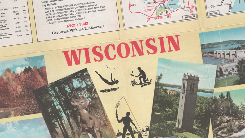
Over the last century, the map has evolved from a route-finding tool to a cultural directory for Wisconsin. The 1918 edition was a map in its purest form and sparsely featured colors. A vivid shade of red was used to highlight the state’s trunk highways. The 1932 edition of the map featured a pictorial state history topped with Wisconsin boldly printed in an art deco typeface. The 1965 edition prominently featured the state’s completed section of the Interstate Highway System.
WisDOT Secretary Craig Thompson said on the agency’s website, “We are excited to share this online archive as a time capsule of Wisconsin’s state highway maps from the past century. We hope Wisconsinites, visitors, and history enthusiasts enjoy this fun opportunity to look back through time and explore the changes to our transportation infrastructure.”
And yes, a new edition of Wisconsin’s Official State Highway Map will be printed this year. With how highways have significantly shaped the history of the United States, I hope that other state departments of transportation follow the lead of WisDOT. Check out the full vintage map archive here.
More from Jalopnik
Sign up for Jalopnik's Newsletter. For the latest news, Facebook, Twitter and Instagram.
